I love doing project based learning with my third graders. I usually have to wait until about halfway through the year before doing "real PBL" because before then they aren't mature enough to work in groups effectively without needing constant intervention. From day 1 I begin teaching them how to work together and how to research. I usually begin with simple projects at the beginning of the year where each student is assigned a certain piece and then when they come all together to make one big project. ANYWAYS- this project I did was closer to the end of this pass year and the kids LOVED IT!! I thought it up after I did a unit on the rain forests and saw just how badly they needed a crash course on the continents!
So after some initial lessons about continents, countries, states, regions... ect. I put my kids in 6 groups of 3-4 and gave them a blank piece of white poster board that only have the outline of their continent. I did Antarctica as an example with the kids first so they had a gist of how to do the project. I did not want to assign Antarctica to a group because it doesn't have all the things they needed to research. After I gave each group their white poster I wrote down the items they had to RESEARCH and HAVE on their continents.
Items needed on their continent:
1. The name of their continent somewhere BIG.
2. The oceans labeled around their continent
3. The largest country on their continent (they could label them all)
4. Languages spoken in their continent
5. Food grown there
6. Animals and plants found there
7. Major Rivers or Lakes
8. Famous landmarks or people found there
9. Weather/climate found there
10. Anything else they found interesting from their research.
The result was mind blowing!
My kids seriously did fantastic. All I did was pull library books on their continents and a few of their countries and pulled up Google on 4 of my computers and Google translate on 2 others. The details they poured into their continents was more than I could ever have hoped for. Everyone was blown away at all the little details and facts. Here is a glimpse at some of them!
We did a giant Titanic unit before this one and here the kids (North America group) drew out the sinking Titanic and the Carpathia coming to save it. They drew it right were it was suppose to be! Awesome!!
The Africa group did a fantastic job drawing all the countries free handed! (Remember, all I gave them was the white poster board with just the continent outlined!) They also drew where the desert was in yellow.
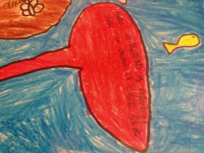
Here you can see where the kids had translated "Hello" in the languages their continent spoke.
Here is a look at South America and their landmark. Amazing!!
I was pleasantly surprised on how well they worked together. They automatically assigned themselves jobs as the researchers and drawers (with NO help from me) and got busy!! The only time we had an issue was when it came to coloring- when all the research was done and all was drawn out they then needed me to put out small arguments because "so and so wasn't coloring in the same direction or in the right color". I took that as them being fiercely proud of their work and just wanting it to be perfect.
Happy Teaching Friends!!!


Do you have the driving question for this project?
ReplyDeleteLOVE this! I can't wait to use this in my (future) classroom!
ReplyDelete